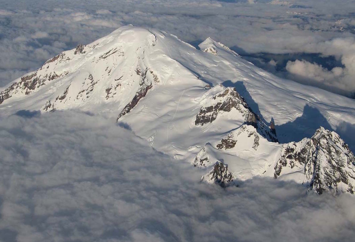
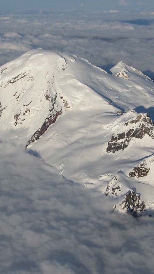
Mount Baker is the crown of the North Cascades. With a summit elevation of 10,781 feet it is the third highest peak in Washington State. What the volcano is famous for is its snowfall. Mount Baker holds the world record of over 1,140 inches in a singe season. There are 9 active glaciers within the mountains slopes. Looking into the Cascade Range it has the second most thermally active crater behind Mount Saint Helens. It was named after Joseph Baker on a expedition to survey the Pacific Northwest in 1792. The original name is Koma Kulshan which translates to “white sentinel” by many local tribes.
The Whatcom County Two Step is a back to back summiting of the two highest peaks in the Country. With Mount Baker and Mount Shuksan being 10 miles apart it’s a great way to spend a weekend. During the season we had put together a plan to climb the 10 Highest Peaks in Washington. Both of which were in on the list and we wanted to do them in the shortest amount of time. It was already May and we had spent most of April picking of the peaks deep in the North Cascades. Bonanza, Fernow, Goode, Stuart and Glacier Peak were already ticked off. From here on out we would be on familiar territory. With a two-day break in the relentless rain it was time to head up north.
Heading for Mount Baker via the Glacier Creek Road
There is nothing like driving four hours to a mountain under cloudy skies. Making our way on to Highway 542 we feared that we read the forecast wrong. Making our way up the Glacier Creek Road it looked even worse. Two miles before the trailhead we were parked and wondering if the trip had stopped before it even started. Jason Hummel, Adam Roberts, Zach Clayton and I packed our bags with low motivation. It was still early in the day and we decided it wouldn’t hurt to check it out.
Skinning towards the winter route we saw a brief break in the clouds. For a quick second we saw the summit of Mount Baker surrounded with blue skies. Before long it was once again absorbed by dark, grey clouds. While wet and nasty down low it was a cloud deck. We just needed to get above it to be basking in glorious sunshine.
Before long we made our way into the clouds. Looking around us we could barely see 10 feet skinning in white-out conditions. With the help of our GPS, we navigated the mellow contours of the slopes. Both Jason and I had been in the area numerous times before. Traversing across Heliotrope Ridge it wasn’t long before we could see the small silhouette of Mount Baker. With each foot the conditions were quickly improving. We had reached the top of the cloud deck and were now in the sun. Below us was an ocean of clouds, but above was a world of white and blue. Happy that we didn’t quiet before the trip even started we pushed our way towards the Coleman Glacier.
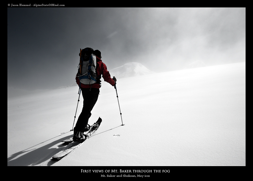
Out of the Clouds and into the Sun on the Coleman Glacier
Each one of us had smiles from ear to ear. All of the concern from previous hours had washed away. To make everything even better there was a few inches of new snow covering all previous tracks. The only thing between us and the summit was 5,000 feet and numerous hours of skinning. Breaking in the skin track we knew it would be amazing riding back down. We were at the high point of the winter snowpack and all the crevasses were buried in snow.
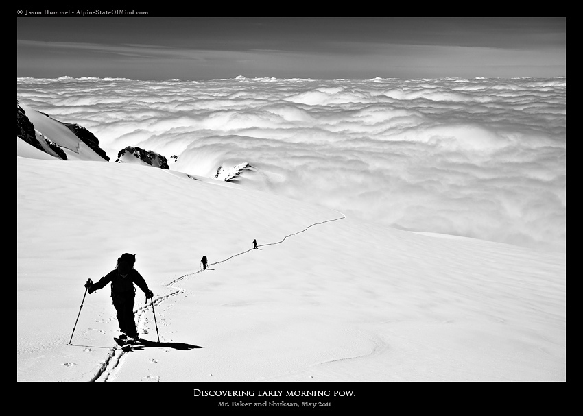
Heading towards the Coleman Deming Col we wondered about the conditions up high. Though we were skinning in powder we wondered if conditions were similar on the Coleman Headwall. We still weren’t sure what our descent would be but soon we would be on the upper slopes. A switchback at a time we switched off breaking trail. Before long we were at the base of the final 2,000 feet to the summit of Mount Baker.
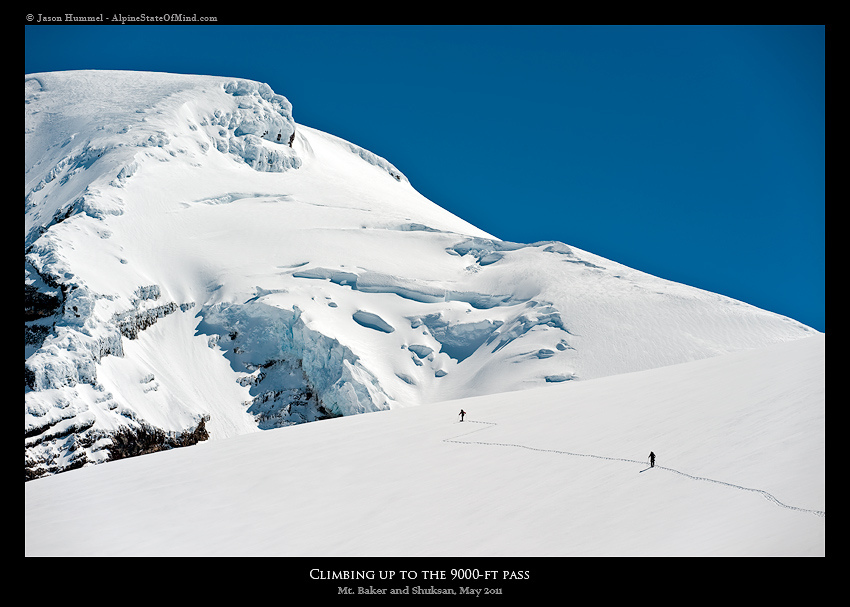
Arriving on the Summit of Mount Baker
Once at the Roman Headwall we decided to switch over to bootpack. It was just steep enough that we would consume more energy skinning. With our boards on our packs we started climbing up the face. While we had powder under our feet we could now feel firm conditions below. Looking towards the surrounding peaks they were still engulfed in the clouds. Soon enough we had made our way to the summit cap and switched back to skinning.
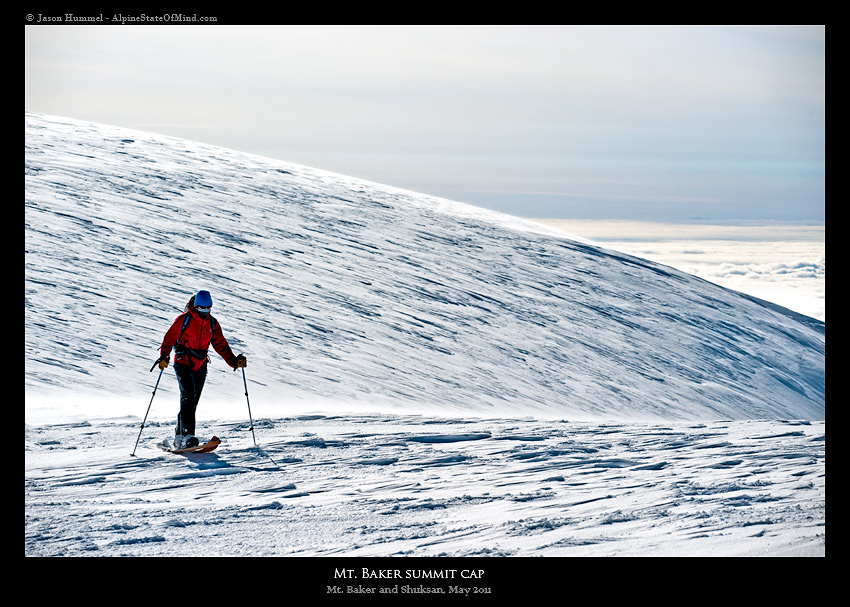
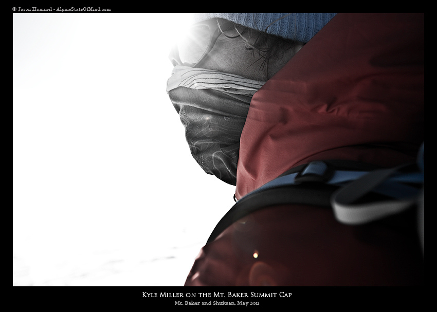
Once on the top of Mount Baker only the highest of the Cascade peaks were above the clouds. We sat on the summit for less than a minute before moving to sheltered area for transitioning. By now the weather window was closing. Both the clouds were slowly rising and the winds had picked up. We knew we had to get out of there fast going over our descent options. We could either ride down the Coleman Headwall or our ascent route. Climbing up the Roman Headwall we had encounter ice below and expected the Coleman to be the same. With that in mind we made a team decision to ride back the way we came.
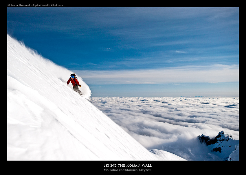
Snowboarding Down the Roman Headwall in Powder Conditions
The sun was lowering as we rode onto the Roman Headwall. With shades of pink and orange highlighting the slopes we kicked up snow with every turn. While there was ice underneath the terrain wasn’t exposed and wide open. Knowing there was nothing to fear below we could open up while riding. Below us we could see from Colfax Peak to Heliotrope Ridge. Below that the Easton Glacier was a sea of clouds. Making the most of the top 3,000 feet we occasionally stopped for photos. Soon we would be back in the sea of clouds but at this moment we were in the sun.
Soon we were over off the Roman Headwall and making our way down the Coleman Glacier. Looking to the west we were happy to see the cloud deck had lowered a bit. We would be able to ride the entirety off the traverse before our final descent. With two hours of daylight left we were now riding low angle powder and gaining ground fast.
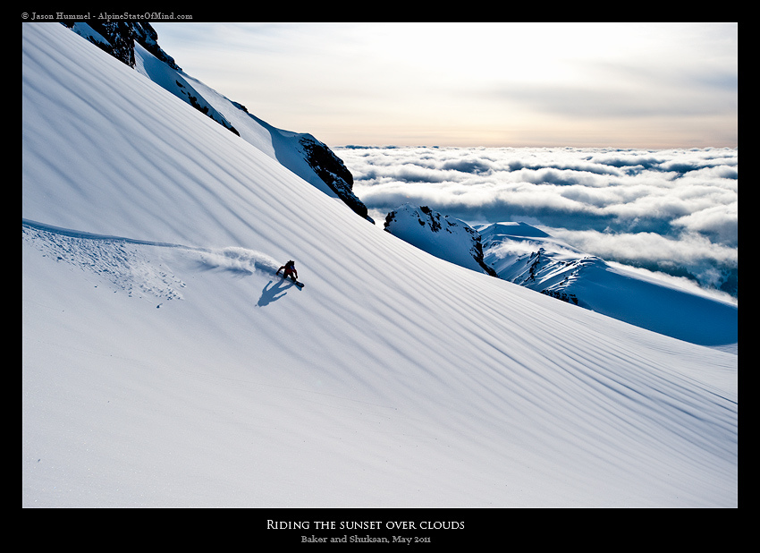
Our Final Turns on Mount Baker Towards the Car
Finally we were making our way across Heliotrope Ridge. With a bit of speed we were able to make it over without transitioning. While the snow was good it was wind effected. With Mount Baker to our backs it was time to make the final descent towards the car. Within a few hundred feet we were back in the clouds. Though normally it would be stressful we were riding fall line back to the road and the trailhead. Loosely following the details of our old skin track we quickly hit the road. With snowpack all the way into the valley we made turns all the way to the car.
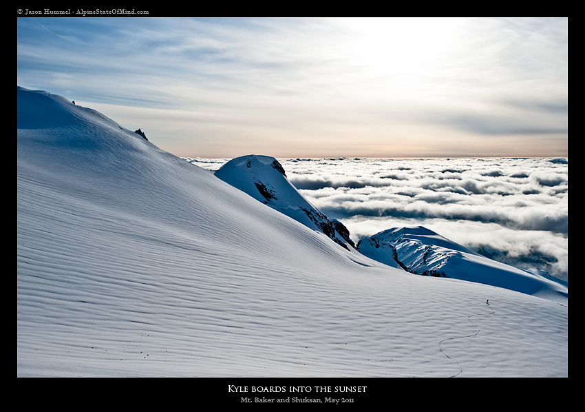
We threw our gear in the car and made a quick dash down to the the town of Glacier. It was our hope to ordering pizza at the local bar. We arrived a few minutes after the kitchen had closed and needed to come up with another option. Driving to the next town we were able to order food minutes before they closed too. We were a bit exhausted from our trip up Mount Baker and needed to regain energy. If all went according to plan, we were going to have another long day on Shuksan. Soon enough we were driving up to Mount Baker Ski Resort for the night.
Stats: 14 miles
elevation gain: 8,500 feet
Dates: May 9th
Thank you for reading this trip report on the Mount Baker
If you want to see more ski tours within the Highway 542 Corridor area check out this link